From Above the Ground Up: Precision Mapping with Drones and LiDAR
When it comes to land mapping and site analysis, speed means nothing without accuracy. At LiDAR Solutions, we combine the latest in drone surveying and lidar scanner technology to give developers, councils, and engineers a smarter way to work.
Our drone surveying service offers rapid data collection across large or hard-to-access areas. Whether you’re working in regional farmland, construction zones, or coastal sites, our drones fly over with precision, collecting detailed imagery and terrain data. You save time on the ground while getting results you can rely on.
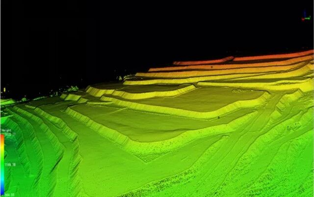
To enhance this process, we integrate a high-resolution lidar scanner with every flight. A lidar scanner uses laser pulses to measure exact distances from the air to the surface. This creates dense point clouds and accurate 3D maps, even through vegetation or uneven terrain. You won’t miss details that matter—every ridge, slope, and structure appears clearly.
Our approach starts with a detailed drone survey, tailored to the unique needs of your site. We assess the landscape, identify the best flight paths, and deploy our team quickly. Once we capture the data, we process and deliver clean, actionable results. Each drone survey gives you the spatial awareness needed to make informed decisions, reduce risk, and move faster through planning or compliance stages.
Our clients across Australia trust us to help them avoid delays, reduce costs, and improve accuracy. From mining companies to environmental consultants, everyone benefits from our efficient, tech-driven workflow.
At LiDAR Solutions, we don't just scan land—we translate it into real-world outcomes. With a skilled team and best-in-class tools, we keep your project grounded in facts and focused on results.
Get in touch with us today to see how our drone and LiDAR technology can lift your project to the next level.


Comments
Post a Comment