Posts

Showing posts with the label drone surveying

Unlocking Precision with Drone Surveying and LiDAR Technology

Image
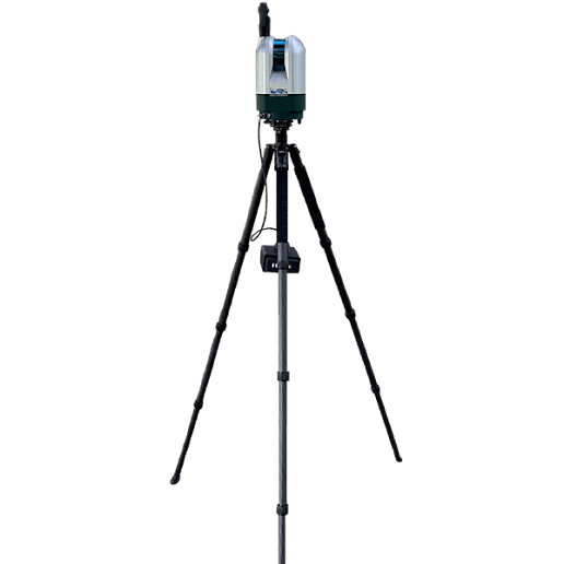
In the world of modern surveying, drone surveying combined with LiDAR scanners is revolutionising how professionals collect data. These advanced technologies offer unmatched accuracy, speed, and efficiency compared to traditional methods. Whether you're working on large-scale infrastructure projects or conducting environmental assessments, drone surveying and LiDAR scanners provide the precision you need to make informed decisions. Drone surveying uses unmanned aerial vehicles (UAVs) to capture data from above. When equipped with a LiDAR scanner, drones can survey vast areas in record time, providing detailed measurements of the terrain without the need for physical access. This makes drone surveying particularly useful for challenging environments such as dense forests, rugged landscapes, or urban areas where traditional methods would be slow, costly, or even dangerous. The real magic happens when the LiDAR scanner is integrated into the drone survey process. The LiDAR scann...

LiDAR Solutions: Leading the Way in LiDAR Surveys, Drone Surveying & 3D Scanning

Image
When precision counts, LiDAR Solutions offers expert LiDAR surveys , drone surveying , and 3D scanning services designed to meet your project’s demands. We combine advanced technology with experienced professionals to deliver accurate and detailed data for a range of industries. Our LiDAR surveys capture high-resolution, three-dimensional information about landforms and structures using laser scanning technology. This method allows us to collect comprehensive data quickly and efficiently, providing you with detailed terrain and site analysis. Whether you’re working on infrastructure, environmental projects, or urban planning, our LiDAR surveys give you the edge in accurate decision-making. Adding drone surveying to the mix, we use UAVs equipped with cutting-edge sensors to access hard-to-reach areas and cover large sites faster than traditional methods. Our drone surveying captures aerial data that complements LiDAR scans, offering comprehensive site views and precise me...

From Above the Ground Up: Precision Mapping with Drones and LiDAR

Image
When it comes to land mapping and site analysis, speed means nothing without accuracy. At LiDAR Solutions, we combine the latest in drone surveying and lidar scanner technology to give developers, councils, and engineers a smarter way to work. Our drone surveying service offers rapid data collection across large or hard-to-access areas. Whether you’re working in regional farmland, construction zones, or coastal sites, our drones fly over with precision, collecting detailed imagery and terrain data. You save time on the ground while getting results you can rely on. To enhance this process, we integrate a high-resolution lidar scanner with every flight. A lidar scanner uses laser pulses to measure exact distances from the air to the surface. This creates dense point clouds and accurate 3D maps, even through vegetation or uneven terrain. You won’t miss details that matter—every ridge, slope, and structure appears clearly. Our approach starts with a detailed drone ...

Accurate Insights from Above: Drone Surveying, LiDAR Surveys & 3D Mapping by LiDAR Solutions

Image
When projects demand precise terrain data and detailed spatial insights, LiDAR Solutions delivers with advanced drone surveying , expert LiDAR surveys , and high-resolution 3D mapping . Our team brings together technology, experience, and local knowledge to support industries across construction, mining, environmental planning, and infrastructure development. Our drone surveying service allows rapid, safe, and accurate data collection over large or difficult-to-access areas. By using UAVs equipped with the latest sensors, we capture sharp aerial visuals and spatial measurements without disrupting operations on the ground. Clients rely on our drone surveying to speed up timelines while improving data reliability. We enhance our mapping with industry-leading LiDAR surveys, which use laser pulses to collect millions of data points in seconds. These high-density scans produce detailed terrain models, perfect for topographical assessments, vegetation analysis, and corridor mapping. Our t...

What is LiDAR and How Drone Surveying Revolutionises Data Collection

Image
Technology continues to transform the way we gather and analyse data. One of the most exciting advancements lies in LiDAR. But what is LiDAR , and why does it matter? Short for Light Detection and Ranging, LiDAR uses laser technology to measure distances with incredible precision. By emitting laser pulses and analysing their reflections, LiDAR creates detailed, three-dimensional maps of the surveyed area. LiDAR Solutions Australia integrates this cutting-edge technology with drone surveying to deliver unmatched accuracy and efficiency. Using drones equipped with LiDAR sensors, we scan vast or hard-to-reach areas quickly. This method captures topographic details, vegetation, structures, and even underground features with exceptional clarity. Understanding what is LiDAR helps highlight its versatility across industries. From construction and mining to agriculture and environmental management, LiDAR provides vital data that aids planning and decision-making. Paired with drones, it bec...

How 3D Scanning in Melbourne is Revolutionising Mapping and Surveying?

Image
Due to its relevance in today's technologically savvy world, Light Detection and Ranging, or LiDAR, is becoming a frequently utilised technology for 3d scanning in Melbourne for a variety of reasons. With this technique, distance may be measured using pulsated laser beams, and the data can then be appropriately transformed into a three-dimensional map of that particular area. These days, 3D laser scanning is really utilised for a wide range of purposes, but for the most part, it is employed to create three-dimensional maps of the surroundings and often it is coupled with drone surveying for best results. Leading products that use light detection and ranging include sensors, survey LiDARs, wind and atmospheric monitoring LiDARs, and additional goods needed for LiDARs, such as automated guided vehicles and PointCloud processing software. Talking About Some of the Main Light Detection and Ranging Technologies Used Wind LiDARs: These devices, as their names imply, are used to ...

Drone Surveying- Opt For Effectiveness and Improved Visualisation

Image
Drone surveying fitted with high-resolution cameras and sensors are used in drone surveying, commonly referred to as aerial surveying or UAV (Unmanned Aerial Vehicle) surveying, to gather data from the air. Numerous advantages offered by this creative method are revolutionising the way surveys are carried out in a variety of industries. Melbourne is welcoming 3D scanning with open arms as it realises how revolutionary technology can be for a wide range of industries. In Melbourne, 3D scanning has a wide-ranging and significant impact on everything from maintaining cultural heritage to improving architectural designs and promoting entertainment. It's fascinating to think about how this advanced technology will continue to change the face of cities in the future. Enhanced Productivity and Time Savings Conventional surveying techniques frequently include much labour- and time-intensive fieldwork. The process is greatly accelerated by drone surveys. Large areas can be swiftly cov...

Drone Surveying: High-Aviation Effectiveness for Precise Data Gathering

Image
When it comes to mapping services, drone surveying is frequently more affordable than satellites, manned planes, or even manual surveying. Drone land surveying is a cost-effective option for all kinds of mapping since it has lower overhead than manual surveying and takes fewer man-hours than surveying with manned aircraft or satellites. Drone footage is either immediately transmitted to a live video feed or captured by the drone operator while operating the drones from the ground. How What is The Significance and Importance of LiDAR Operated? Understanding what is lidar scanning, a laser beam is pointed at the ground, and the time that it requires for the light to reflect is measured. A thorough map of the region is then made using this data. Fundamentally, LiDAR is an approach to remote sensing that measures an object's distance using light in the manner of a pulsed laser. Rapid laser pulses are sent towards the target region in the basic setup and the duration of time it re...

Discovering the Levels of Light Observation and Ranging with LiDAR

Image
LiDAR , an optical technology, is frequently mentioned as a crucial technique for driverless cars to sense distance. Several businesses are attempting to create tiny, affordable LiDAR systems. It pulses laser light and counts how long it takes for the light to strike an item and return to the sensor. Since the pulses are released every nanosecond, it is possible to scan an area quickly and thoroughly while obtaining precise 3D pictures that may be used to make elevation maps and other projects. Finding Possible Risks and Lowering Employee Risk Drone surveying and inspections provide several benefits, chief among which is their capacity to detect any safety risks. Drones fitted with thermal imaging sensors and cutting-edge algorithms may identify irregularities that can point to structural deterioration or other problems. Drones, for instance, can detect leaks in tanks that could endanger worker safety or fractures in pipelines or metal buildings. Furthermore, personnel no longer ne...